
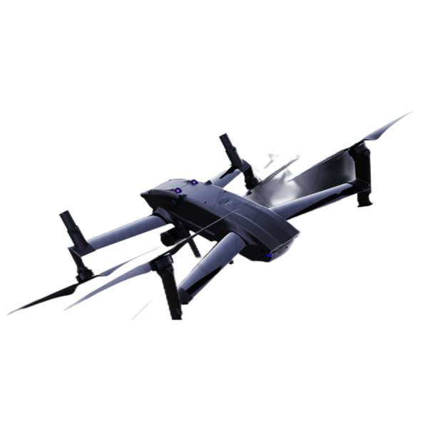
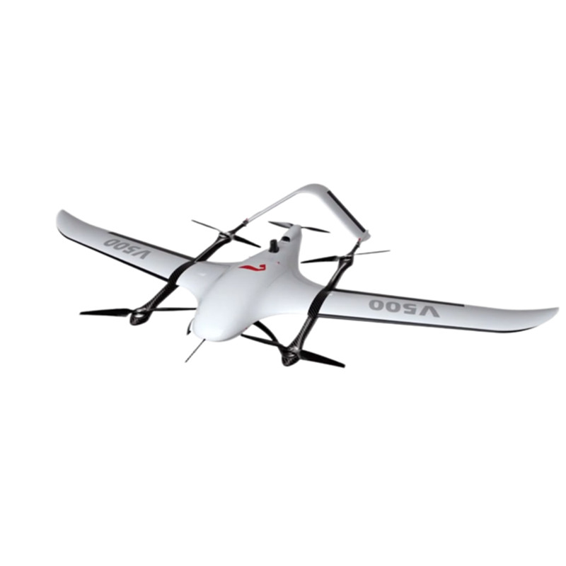
Full Electric Fully intelligent UAV EDING V500 for Survey and Mapping
Product Introduction
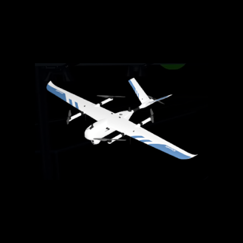
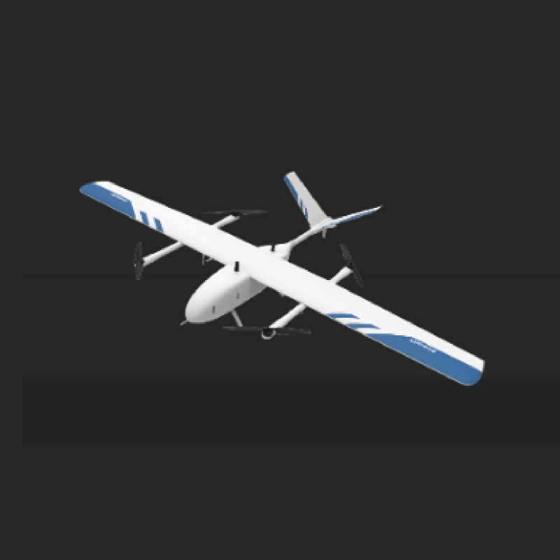
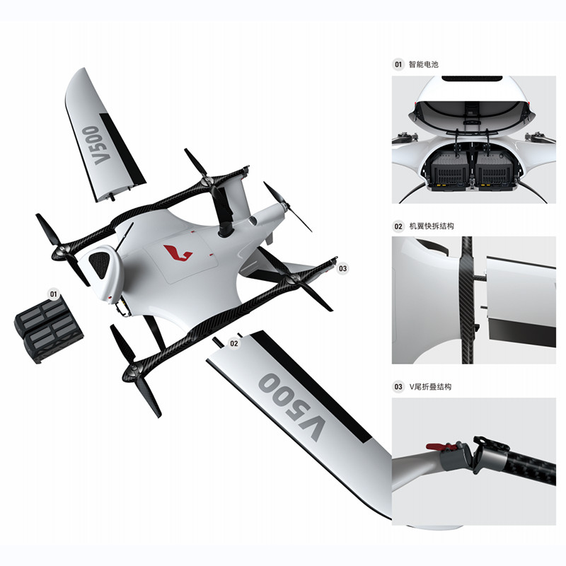
Crafted using Kevlar + PMI composite materials, the V500 boasts a remarkably low take-off weight of only 7.2kg, while offering an impressive flight time of up to 180 minutes. Its modular quick-release and folding design for the fuselage platform streamlines assembly steps, enhancing operational efficiency.
The V500 offers two standard options: the orthographic version and tilted version, catering to the diverse and customized needs of different users. Equipped with a high-precision differential GNSS board, it supports PPK, RTK, and their fusion operation modes, enabling 1:500 mapping without control points and POS-assisted aerial triangulation. Notably, it facilitates image control-free applications.
Included with the V500 is the "UAV Manager Professional Edition", a comprehensive intelligent GIS system for UAV data acquisition, processing, display management, and UAV maintenance. This system supports various flight platforms, including fixed wing and rotary wing, and offers a wide range of route modes to meet diverse application needs.
Furthermore, the V500 supports accurate 3D route planning based on true 3D terrain data, real-time flight monitoring, fast flight quality inspection, and a rich data preprocessing toolbox. It also provides robust precision control and automatic mapping, along with the production of rich 4D and three-dimensional results. The visual monitoring center, cloud services for system upgrades, intelligent maintenance, and information push further enhance the overall user experience.
In summary, the V500 represents a state-of-the-art UAV system that combines advanced technology with unparalleled efficiency, making it an ideal choice for professionals seeking high-performance, reliable, and versatile aerial data acquisition solutions.
Specifications
Material |
Kevlar + PMl |
folding size |
2296mmx1280mmx257mm |
Take-off weight |
6.8kg(with Orthophoto camera)/7.2kg(with tilt camera) |
Power mode |
Pure-Electric |
Cruising speed |
17m/s |
Max speed |
26m/s |
Endurance |
3h(with Orthophoto camera)/2.5h(with tilt camera) |
Operation range |
150km(with Orthophoto camera)/120km(with tilt camera) |
Take off height |
0m~5000m (altitude) |
Service ceiling |
7000m (altitude) |
Wind resistance |
level 7 |
Control range |
25KM |
Take-off and landing way |
VTOL |
Work temperature |
-20℃~50℃ |
Sensor parameters
Laser class |
Class1 |
Maximum ranging |
120m |
Echo strength |
8bits |
Camera resolution |
500w |
Number of laser channels |
16 |
Dot frequency |
320kpts/s |
Number of cameras |
3 |